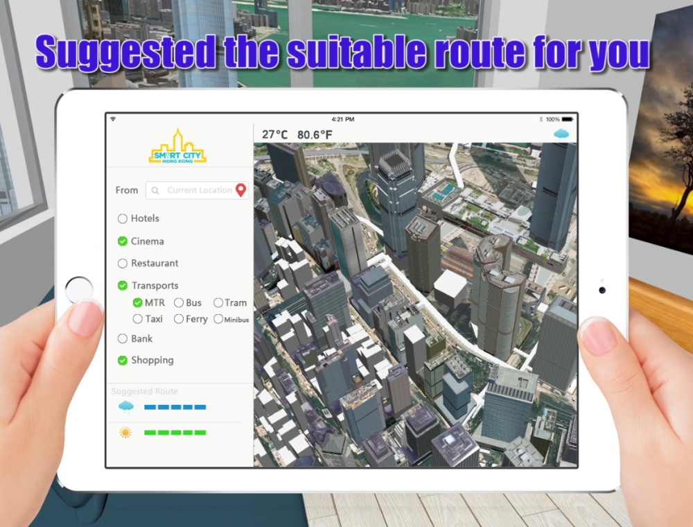
The Lands Department has started to create a citywide 3D pedestrian network, through which people can use the GPS function on their mobile phone to look for their position and the route to their destination.
The Lands Department has started to create a citywide 3D pedestrian network, through which people can use the GPS function on their mobile phone to look for their position and the route to their destination.